Your trips,
beautifully told.
WanderScript turns your journey into something worth keeping — interactive maps, expense tracking, photo galleries, and AI-written narratives that capture every moment of your travels. Share it with your friends and family, or keep it for yourself — forever.
Travel. Capture. Tell the story.
Everything you need to capture a trip while it's happening — and turn it into something worth coming back to.
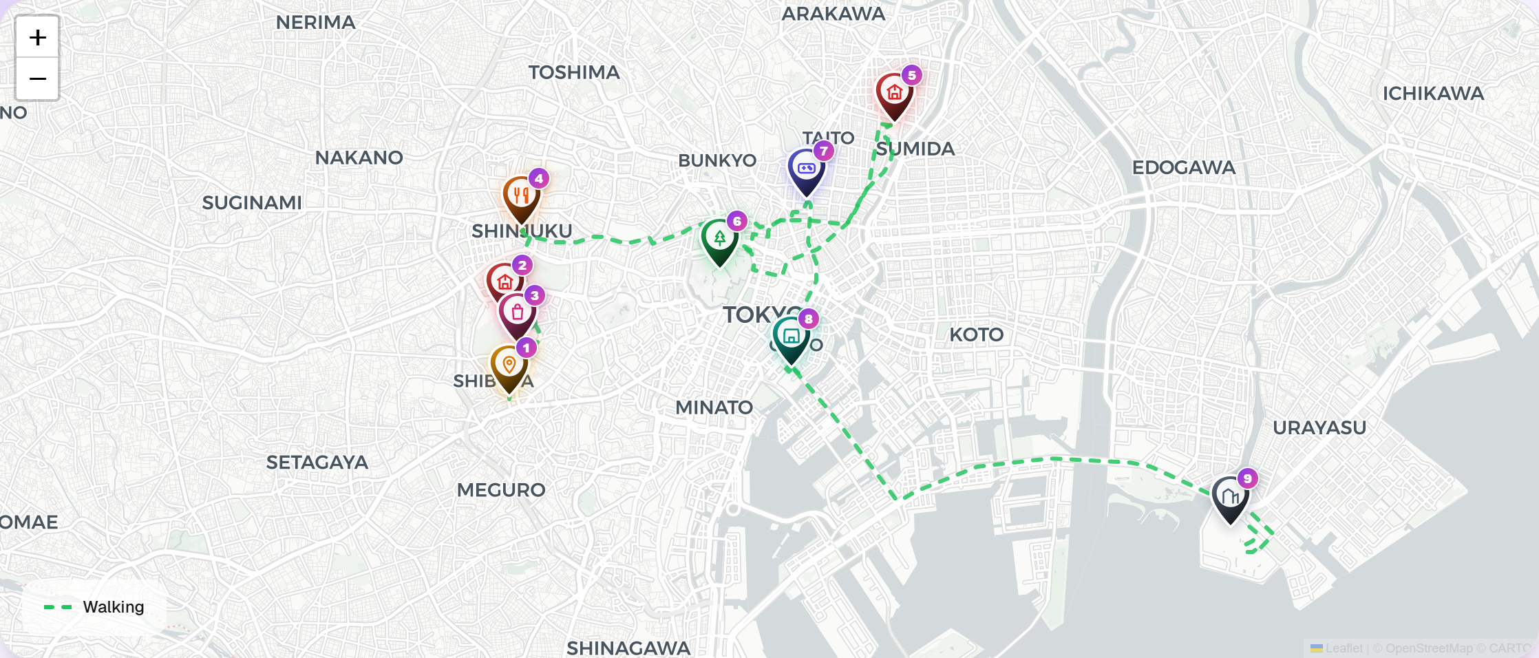
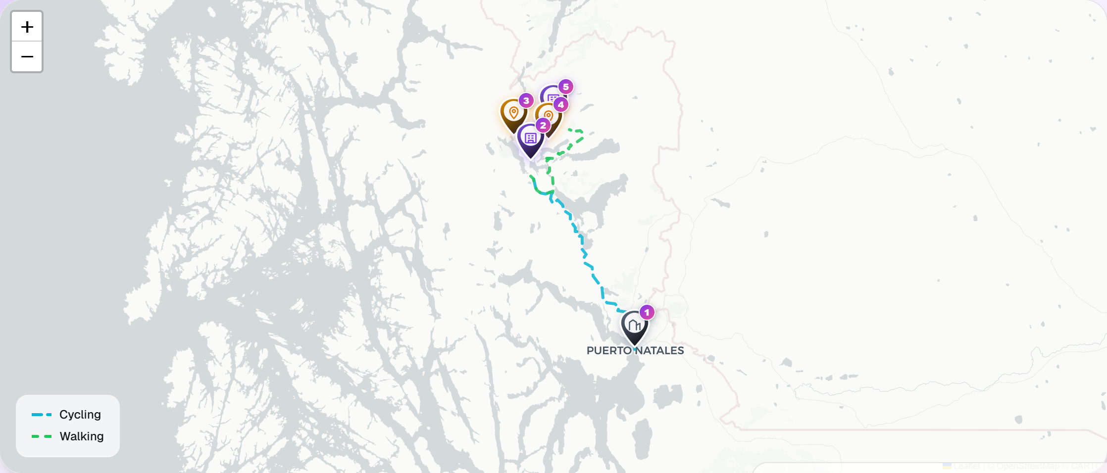
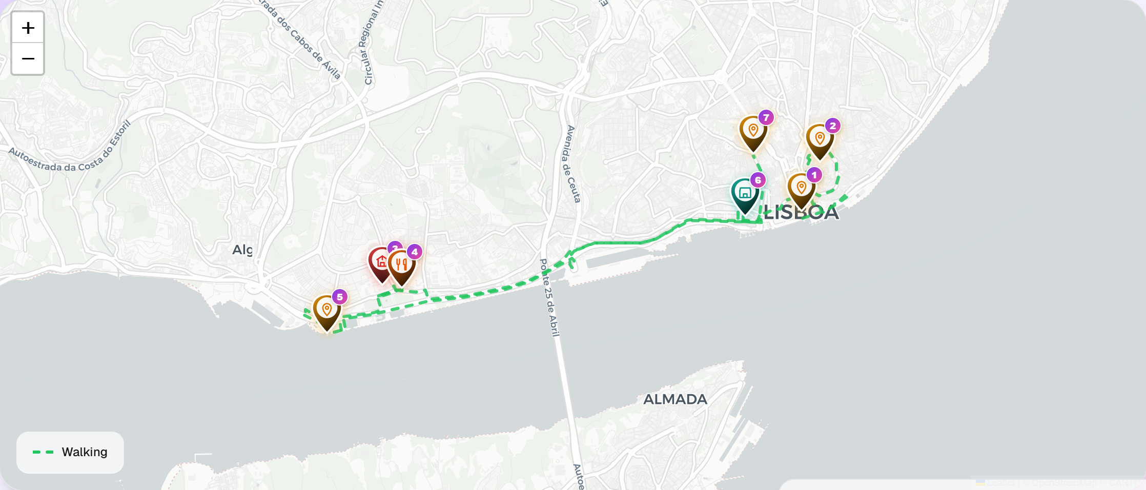
Interactive maps, drawn from your steps.
Every stop plotted, every route traced. Pan, zoom, and feel the shape of where you went — not just the bullet points.
AI-written narratives
A warm, personal travelogue written from your stops and notes — choose a tone and make it sound like you.
Expenses, by day
Log what you spend as you go — food, transit, stays — and see where the money actually went.
Photos by place
Attach photos to the stops that matter — so every memory has a place on the map.


Import GPX from anywhere
Strava, Garmin, Komoot, your watch. Drop in a GPX file and your route appears — stops, elevation, and all.
Collaborate, publish, or keep it private.
Invite the people you travelled with, share a beautiful read-only page, or export everything as a PDF keepsake.
 Asakusa · 09:42
 Skytree · 13:31
 Sumida · 16:15
 Side street
Your journey, written back to you.
The morning mist hung over Asakusa as we wound through the red lanterns of Senso-ji, the smell of incense and fresh taiyaki drifting from the side streets. A monk rang the bell at 9:42 — we'd been up since six, and we hadn't eaten.
By midday the skyline had cleared. From the observation deck of the Skytree the city stretched out as a grid of grey rooftops cut by the Sumida, the Tokyo Tower a red dash against it all.
Pick a tone — literary, casual, or just-the-facts — and regenerate until it feels like yours.
Plan it, live it, remember it.
Build your trip
Add stops, dates, and notes. Invite the people travelling with you so everyone stays on the same page.
Check in as you go
Log photos, receipts, and moments as they happen. Tag them to the stop they belong to.
Let AI tell the story
Generate a narrative in the tone you choose — literary, casual, or just-the-facts. Edit until it sounds like you.
Share or keep it
Publish a beautiful read-only page, export a PDF keepsake, or just keep it for yourself. Forever yours.
Trips, as other people told them.
A preview of the format. Real public trips will appear here at launch.
Keep the trip after the trip.
We'll email you the moment WanderScript opens. No spam, no calendar invites, no "quick syncs."